The Examples Gallery of scanned by us German Luftwaffe and Allied Air Force Aerial Reconnaissance Photographs
- Compare of scanning quality. The one was made by our service and the other was made by other scanning service. This one piece, cut off from the photograph, was sent to us by our customer, to make a quality compare.
- Panoramic Luftwaffe Aerial Reconnaissance Photograph (Reduced size).
- Average scale: 1:12000, 1200 pixels/inch, 100% zoom crop(Average quality of the sortie - "Good", as marked in the archive reference information).
- Winter time. Average scale: 1:12000, 1200 pixels/inch, 100% zoom crop(Average quality of the sortie - "Good", as marked in the archive reference information).
- Average scale: 1:20000, 1200 pixels/inch, 100% zoom crop(Average quality of the sortie - "Good", as marked in the archive reference information)
- Average scale: 1:38000, 1200 pixels/inch, 100% zoom crop(Average quality of the sortie - "Good-Fair", as marked in the archive reference information).
- Average scale: 1:54000, 1200 pixels/inch, 100% zoom crop(Average quality of the sortie - "Fair", as marked in the archive reference information).
- Tanks on the battlefield. Average scale: 1:15000-1:20000, 1200 pixels/inch, 100% zoom crop(Average quality of the sortie - "Good", as marked in the archive reference information).
- Tanks on the battlefield 2. Average scale: 1:15000-1:20000, 1200 pixels/inch, 100% zoom crop(Average quality of the sortie - "Good", as marked in the archive reference information).
- Airplanes on the airfield. Average scale: 1:15000, 1200 pixels/inch, 100% zoom crop(Average quality of the sortie - "Good-Fair", as marked in the archive reference information).
- Allied Aerial Reconnaissance Photograph of Koenigsberg (Kaliningrad). Dated 27 August 1944, Average scale: 1:9500, 600 pixels/inch, 100% zoom crop(Average quality of the sortie - "Good", as marked in the archive reference information)
- Example of the preview of German Luftwaffe Aerial Reconnaissance Photograph 36 pixels/inch
- Google Earth, PC version, orthorectified KMZ-file, which we always provide with the preview.
How to use?
Compare with tactical war maps
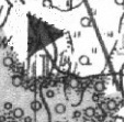
On the German Luftwaffe or Allied Aerial Reconnaissance Photograph, you can see the real position of fortification objects, which were been marked on the headquarters maps. For example: On the german headquarters map, scale 1:50000, you can see the flag of batallion headquarters:
To see objects destroyed during WW2
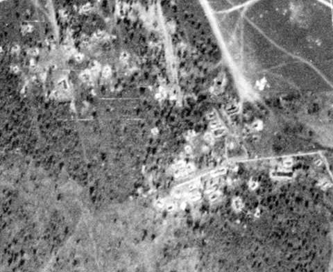
For historical research, on the German Luftwaffe or Allied Aerial Reconnaissance Photographs, you can see exact locations of the object, which were destroyed during Second World War. These objects are: historical monuments, burned wooden houses, demolished churches, destroyed barracks and headquarters and etc. Here you can see the German Luftwaffe Aerial Reconnaissance Photograph, orthorectified and overlaid by us, over the satellite image:
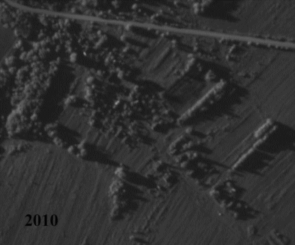
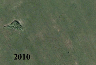
Compare the landscape
On the German Luftwaffe of Allied Aerial Reconnaissance Photographs, you can see the destroyed in the post-war time, fortification objects. Here you can see the German Luftwaffe Aerial Reconnaissance Photograph, orthorectified and overlaid by us, over the satellite image: